Makhtesh Ramon
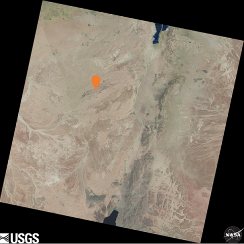
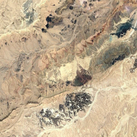
| Landsat 8 LandsatLook image Path 174 Row 39 Acquired 24 Aug 2020 with ROI indicated | Google Earth Image centered on Makhtesh Ramon ROI |
Makhtesh Ramon (also known as Ramon Crater) is a geological feature of Israel's Negev Desert. The crater is a flat drainage basin bounded by steep walls — the formation is 40 km long, 2 to 10 km wide, and 500 meters deep. Due to the arid conditions, vegetation and soil cover are limited; in addition, the area is nearly free of clouds throughout the year. The annual precipitation is 25 millimeters.
This site is an important calibration site for Hyperspectral Remote Sensing (HSR) data from both airborne and orbital sensors. Many satellites have captured this site over the years, including Landsat, SPOT-5-7, Proba CHRIS, WorldView-1-3, KOMPSAT-3, and SuperView-1. Past studies demonstrate the site as an ideal location for evaluating PRecursore IperSpettrale della Missione Applicativa (PRISMA) sensor’s capabilities also [1].
Recently, this site has been chosen by NASA for vicarious calibration of the forthcoming Earth Surface Mineral Dust Source Investigation (EMIT) HSR sensor to be mounted on the International Space Station in 2022.
| Location (City, State, Country): |
Makhtesh Ramon, Southern Israel, Asia
|
|---|---|
| Landsat WRS - 2 Path / Row: |
174/39
|
| Center Latitude (degrees): |
N 30.59
|
| Center Longitude (degrees): |
E 34.84
|
| CEOS Region of Interest |
N 30.59, E 34.84 Search this area in EarthExplorer (Landsat 8-9 Collection 2 Level-1) - date range, datasets, cloud cover and other criteria can be modified once initial results are returned |
| Altitude above sea level (meters): |
557
|
| Purpose: |
Radiometry
|
| Co-located Instrumented Networks: |
AERONET
|
| Status: |
Active
|
- Heller Pearlshtien, Daniela, Stefano Pignatti, Uri Greisman-Ran, and Eyal Ben-Dor. "PRISMA sensor evaluation: a case study of mineral mapping performance over Makhtesh Ramon, Israel." International Journal of Remote Sensing 42, no. 15 (2021): 5884-5916.
- C. Wang and S. W. Myint, "A Simplified Empirical Line Method of Radiometric Calibration for Small Unmanned Aircraft Systems-Based Remote Sensing," in IEEE Journal of Selected Topics in Applied Earth Observations and Remote Sensing, vol. 8, no. 5, pp. 1876-1885, May 2015, doi: 10.1109/JSTARS.2015.2422716.
- Notesco, G.; Ogen, Y.; Ben-Dor, E. Mineral Classification of Makhtesh Ramon in Israel Using Hyperspectral Longwave Infrared (LWIR) Remote-Sensing Data. Remote Sens. 2015, 7, 12282-12296.
Note: This information has been compiled by the USGS ECCOE Team, using the best sources currently known. Updates will be made as more information becomes available. Please contact eccoe@usgs.gov with any updates you would like to contribute.


